
(+47) 915 98 728 dominika.krzeminska@nibio.no Office Location: Ås O43
Models are integral part of any restoration and/or mitigation and climate change adaptation plans. At NIBIO, there are scattered model-based studies on establishing/optimising mitigation measures for reducing flash floods, increasing water, soil and material retention in the catchment, and reducing the loads of soil particles, nutrients, pesticides and other contaminants to freshwaters.
(+47) 915 98 728 dominika.krzeminska@nibio.no Office Location: Ås O43
& EMG Representant(s):
Selected material in HQ:
The applicability of various models to simulate the effect of mitigation measures on water and mass retention/transport within the landscape (SirkVann project, internal report)
OPTAIN modeling webinar - location of measures
Spatial planning of water retention measures (SirkVann project, internal report)
When mathematical modeling is chosen as a basic tool for a certain study / purpose, we need to select the most appropriate model(s) based on the goals of the study, data availability, modeling expertise and other conditions (Waveren et al., 1999; Farkas and Hagyó, 2010). The outcome of a particular simulation-based study strongly depends on:
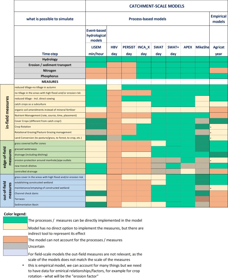
At NIBIO, we have developed a matrix that could be used in the future by the NIBIO modelers for model selection in projects/studies when the effect of various mitigation measures is in focus. At present, it incorporates 18 different field- and catchment- scale models and 22 in-field and out-field measures. We defined three levels of representing the measures within a model:
Relevant project(s):
The table above shows that (some) in-field mitigation measures (management measures) can be directly implemented in several models (e.g SWAP), by using/adopting specific parameters. When it comes to out-field mitigation measures such as constructed wetlands, grass waterways etc, only spatially distributed models (LISEM, SWAT+ etc.) have the capacity to directly incorporate them in the model.
In addition, there are options to account for both in-field and out-field mitigation measures and estimate the effects of such measures indirectly, using expert judgments and specific parameterisation (INCA, PERSiST, SWAP).
To account for measures in modeling approaches, their parametrisation is key. It can be very intuitive in some cases, in others it may need serious adaptation in model setups. Within the OPTAIN project the guidelines for parameterisation of measures were prepared (under review)
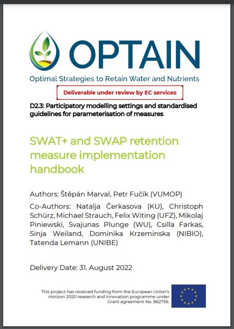
Here one can find detailed descriptions how to include mitigation measures into SWAT+ and SWAP model. See OPTAIN project website for more information about the measures studies in the Norwegian Case Study.
Relevant project(s):
One of the most common questions asked, when working with mitigation measures, is about the optimal location that would lead to reaching expected efficiency of these measures. Terrain analysis, based on readily available geodata, can provide a starting point for answering these questions.
Find out more about selection of optimal location for measures in the three documents listed below:
NOTE: The premise for all methods presented here is that the required data are readily available in Norway’s national geodata repositories, and therefore applicable at any spatial scale without additional data acquisition.
Relevant project(s):
No abstract has been registered

The general principles of the water use and protection are established by the Water Act, which is based on the EU Framework Directive on water policy and the Framework Directive on the sea strategy in order to ensure sustainable development and the natural status of water, and keep the quality, amount and regime of surface and groundwater as unviolated by human activity as possible. The aim of both directives is to ensure or acquire a good water status of inland bodies of surface water and coastal waters by 2015 and for the sea by the year 2021.
OPTAIN proposes a social and scientific journey toward the increasing and better understanding of the multiple benefits of Natural/Small Water Retention Measures (NSWRM). The Norwegian case study area, Kråkstadelva catchment, is located within the Hobølelva watershed 30 km S-SE of Oslo.