Meetings in Norway
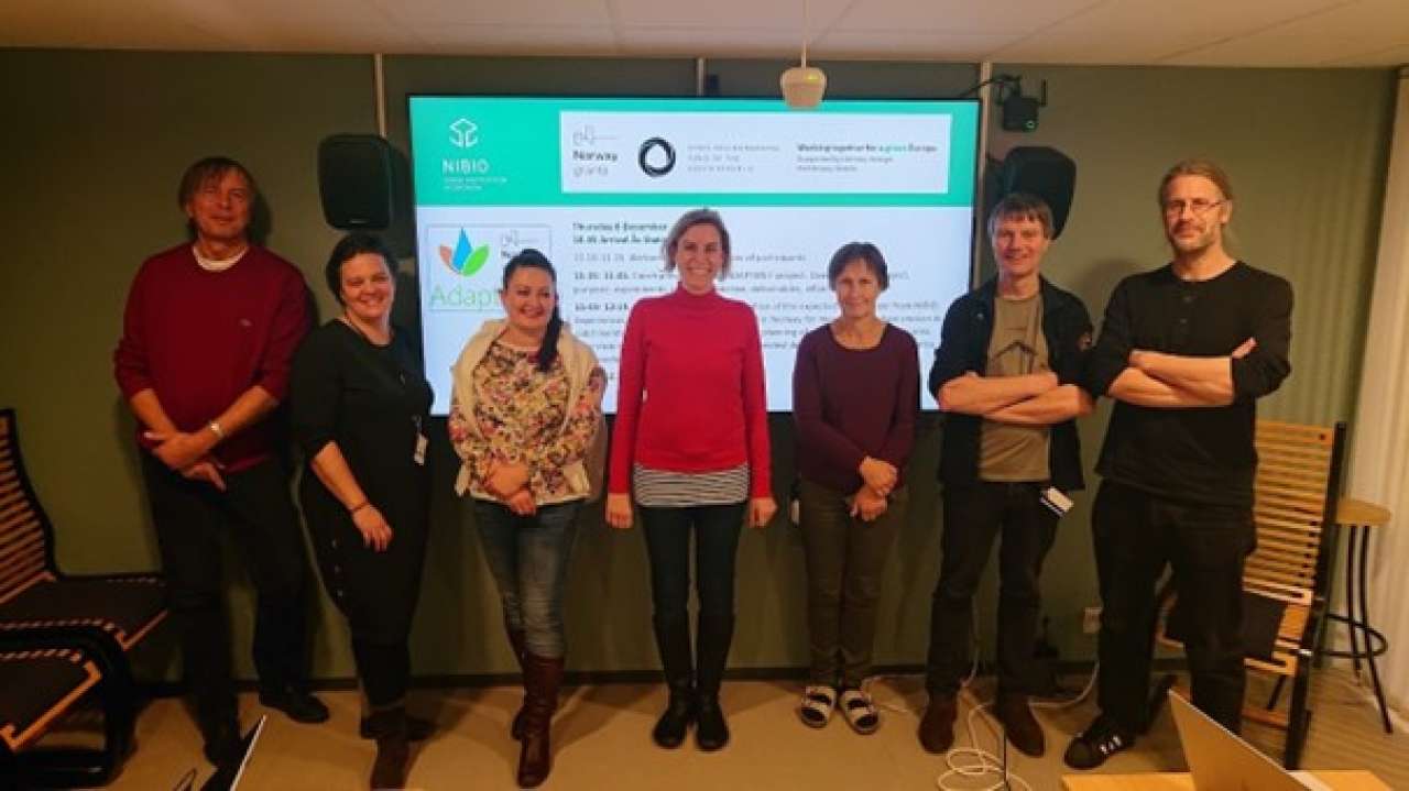
Project leader of AdaptaN- II Miroslav Dumbrovsky (Brno University of Technology). Dominika Krzeminska (NIBIO), Marcela Pavlikova and Veronika Sobotkova (Brno University of Technology), Lillian Øygarden, Jannes Stolte and Robert Barneveld (NIBIO). Photo: NIBIO.
In the Adapta N project researches meet in Norway and Czech republic. Meetings in Norway combine field excursions with project discussions.
Project meeting 8- 9 December 2022 at NIBIO, Ås.
Professor Miroslav Dumbrovsky presented the AdaptaN-II project, partners, project goals and study area. Discussion of NIBIO experience and work for the AdaptaN II project. Veronika Sobotkova- administrative conditions AdaptaN- II, webpage and plans for promoting the project.
Presentations from NIBIO: Jannes Stolte: Overview of NIBIO Institute, projects with flood risk and retention systems in landscape. Robert Barneveld: New erosion risk maps of Norway (sheet erosion and gully erosion). Field measurement and modelling of gully erosion. Modelling measures in landscape. Dominika Krzeminska; Bufferzones- effects, location in landscapes, planning procedures. Marianne Bechmann. Norwegian Agricultural Monitoring Programme and Kjelle experimental plot study.
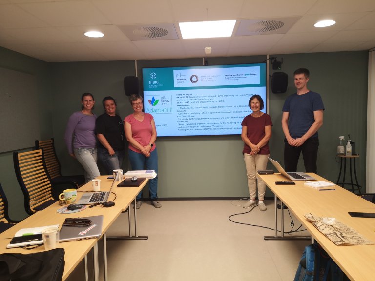
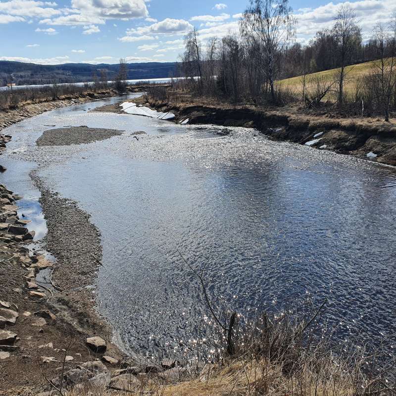
Project meeting and excursion 23 - 24 August 2023
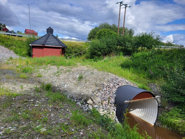
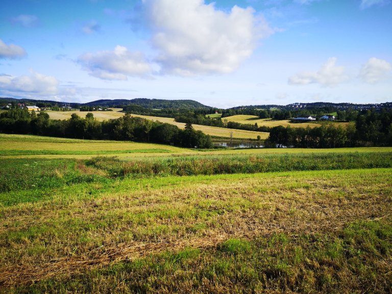
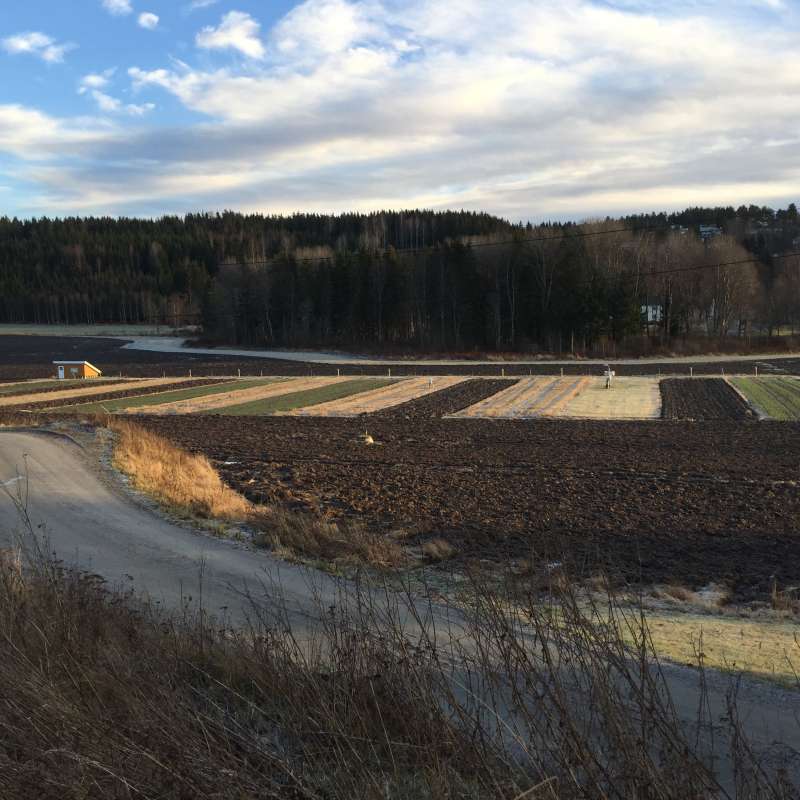
24 August and 25 August (half day). Excursion in agricultural landscape to see typical agricultural production systems and farming practices, landscape measures to reduce erosion, NIBIO -monitoring stations and field research locations.
Contacts
Lillian Øygarden
Head of Research
-
Division of Environment and Natural Resources
(+47) 916 84 113 lillian.oygarden@nibio.no Office Location: Ås O43
Hellerud experimental field.
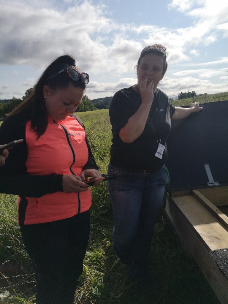
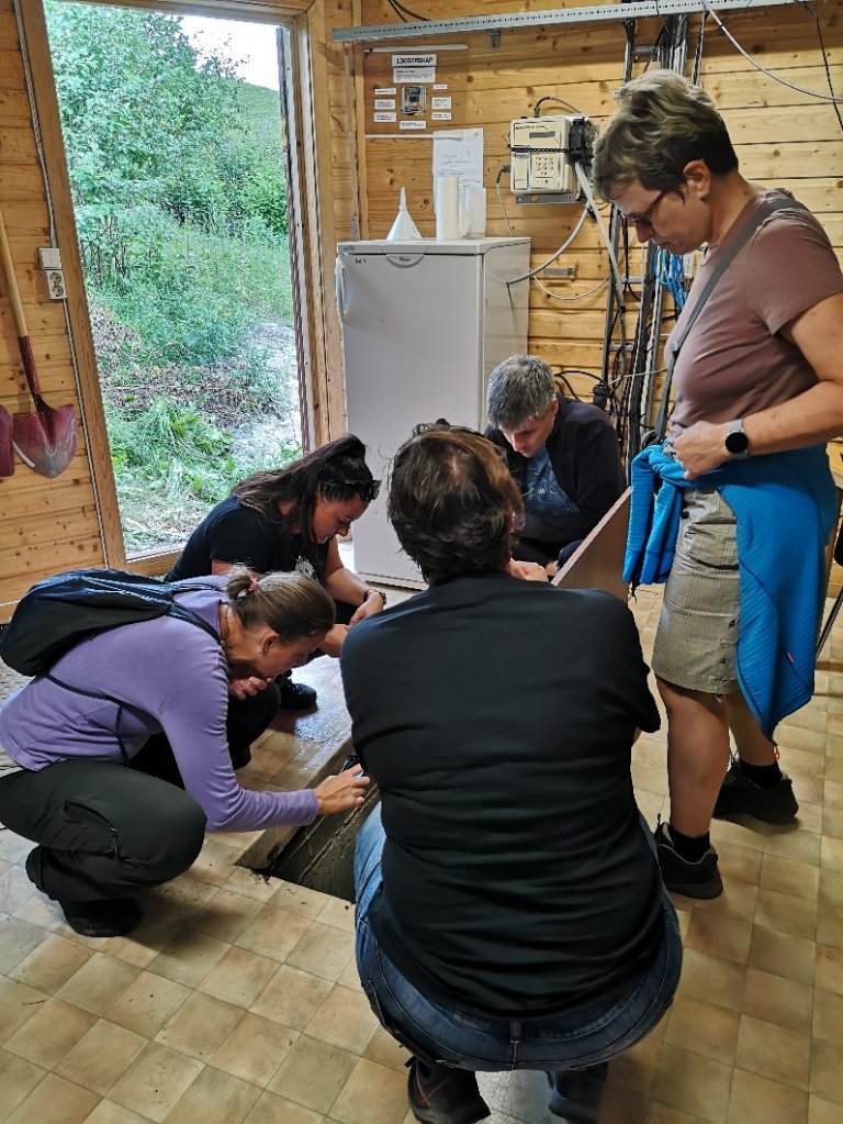
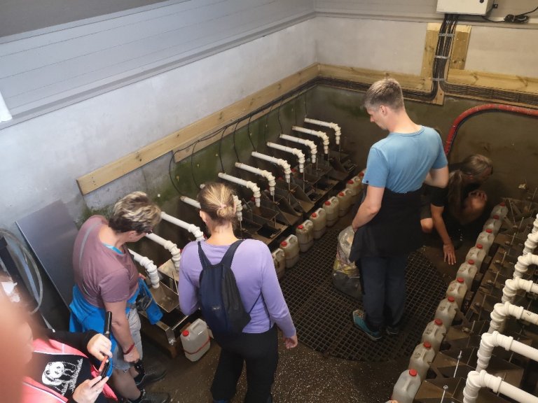
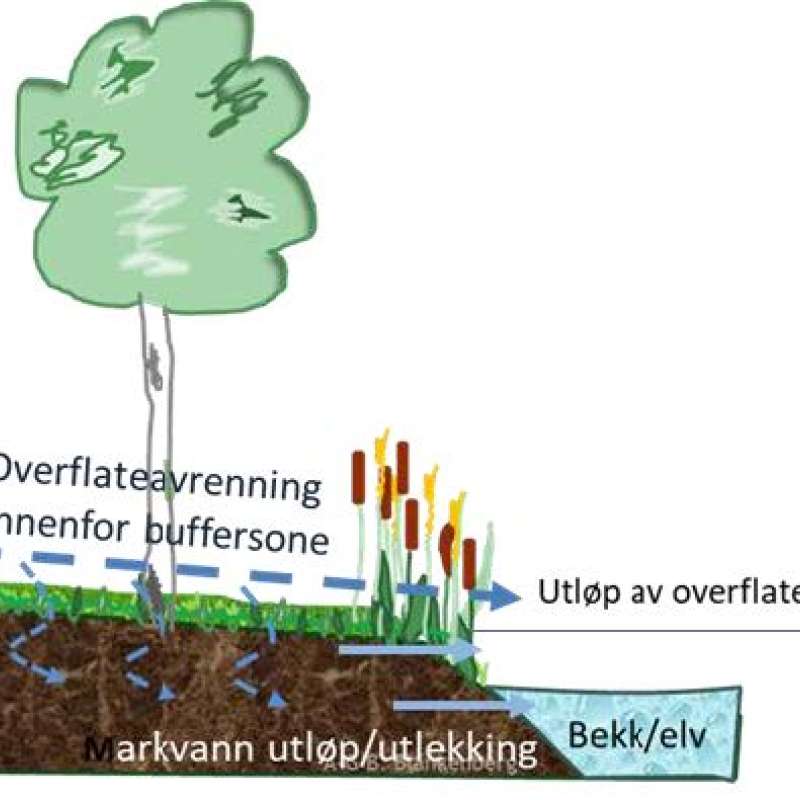
Demonstration of the monitoring system for runoff measurement and water sampling. Plot studies of effect of bufferzones. Contact person: Dominika Krzeminska.
Overview of erosion in Norway due to land levelling and measures to reduce erosion. Overview of landscape erosion and contributions to lake Øyeren.
Mørdre catchment
Mørdre is one of the catchments in the JOVA programme- The National Agricultural Environmental Monitoring Programme.
Demonstration of the monitoring system and equipment for runoff measurement and water sampling.
Overview of the scales for monitoring and research: catchment, field scale, and plot studies in the monitoring period for the Mørdre catchment. Overview of agricultural production systems and environmental measures. Trends in water quality. Overview of measures to reduce erosion, tillage, bufferzones, sedimentation ponds.
Kjelle Experimental Plot study
Kjelle runoff plot study is a soil tillage project with measurement of runoff of soil particles, nutrients and pesticides through surface- and subsurface pathways.
Skuterud Catchment
Skuterud is one of the catchments in the National Agricultural Environmental Monitoring Programme.
Presentations at project meeting 25 August
Presentations from NIBIO.
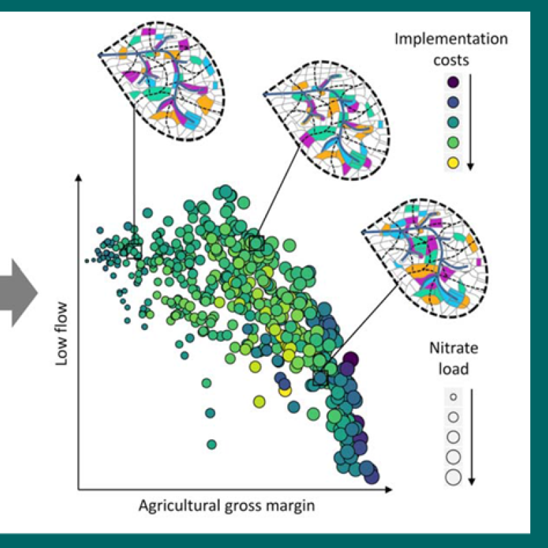
Csilla Farkas, NIBIO. Modelling -effect of different measures in agricultural landscapes with different scenarios. Modelling- us of experimental data from locations in Kråkstad area.
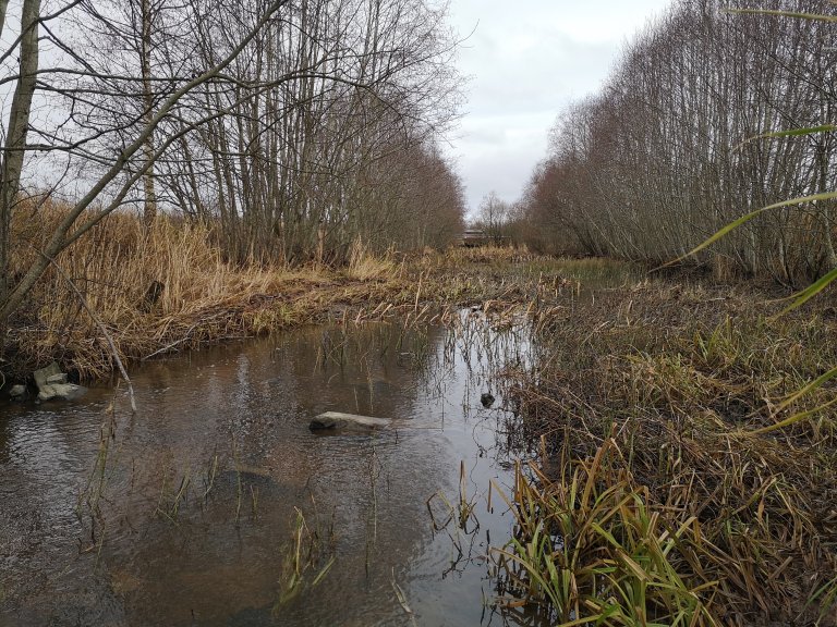
Dominika Krzeminska. Bufferzones – establishment and development in Kråkstad area- examples from Optain project. Example from Gjøding elva. https://youtu.be/NI9CxY8Ourw
Presentations from T. G. Masaryk Water Research Institute:
Pavla Štěpánková. Presentation of Masaryk Water Institute and especially the work and experience with projects on hydrology and flood protection.
Martin Caletka. Presentation of work with measures in the agricultural landscape, erosion control, project activities in AdaptaN- II.
Contacts
Lillian Øygarden
Head of Research
-
Division of Environment and Natural Resources
(+47) 916 84 113 lillian.oygarden@nibio.no Office Location: Ås O43
Publications
Abstract
No abstract has been registered
Abstract
Constructed wetlands (CWs) are a widely recognised measure for reducing pollution loads and improving the quality of surface waters. The removal efficiency of CWs varies considerably depending on system type and design as well as residence time, hydraulic load, particles and nutrient loading rates. Therefore, there is a need to closely monitor the efficiency of existing measures, look at their efficiency in practice and be able to foresee potential implications for their efficiency in light of climate change and land management intensification. This study presents 18 years of data from a typical Norwegian small CW established in the Skuterud catchment. The main objective of this study was to look at the impact of hydraulic load, particles and nutrient loads (depending on climatic factors such as temperature and precipitation) on CW effectiveness. The results showed an average of 39 % and 22 % annual removal efficiency for sediment and phosphorus, respectively. It appears that good CW effectiveness coincides with a combination of high sediment or phosphorus loads to the CW and a stable runoff of low to moderate intensity. At the seasonal level, the highest sediment and phosphorus removal efficiency is observed in the summer seasons (47% for sediment and 29% for phosphorus), when the sediment and phosphorus loads and runoff are at their lowest, and the lowest in autumn (23% for sediment) and in winter (4% for phosphorus). The relationship between removal efficiency and loads to the CW is not that straightforward, as other seasonal differences, such as erosion patterns, vegetation development, also become important. The conclusion based on the results presented is that establishing CWs can be a good supplement to best management practice in erosion-prone catchments with sensitive recipients.
Abstract
No abstract has been registered
Abstract
No abstract has been registered
Report research – Phosphorus losses from the Mørdre catchment
Dominika Krzeminska, Marianne Bechmann
Abstract
No abstract has been registered
Projects
Division of Environment and Natural Resources
Kjelle runoff plot study
Division of Environment and Natural Resources
OPTAIN: Optimal strategies to retain and re-use water and nutrients in small agricultural catchments
OPTAIN proposes a social and scientific journey toward the increasing and better understanding of the multiple benefits of Natural/Small Water Retention Measures (NSWRM). The Norwegian case study area, Kråkstadelva catchment, is located within the Hobølelva watershed 30 km S-SE of Oslo.
Division of Environment and Natural Resources
TOTBUFFER: Vannstrøm i og under overflaten gir ny kunnskap om renseeffekt av buffersoner
Division of Environment and Natural Resources
N4S: Naturbaserte løsninger (NBS) for for stabilisering av skråninger/bekkekanter
Prosjektet skal bidra til å styrke forskning på naturbaserte løsninger (NBS) som også styrker karbon nøytrale løsninger, øker biodiversitet og bærkraftig bruk av arealer i bekkedrag. Det skal gjøre det enklere å prioritere bærekraftige løsninger for erosjonssikring.
%20combined%20bufferzone-2.jpg?quality=60)