Michael Angeloff
Senioringeniør
(+47) 975 38 594
michael.angeloff@nibio.no
Sted
Ås - Bygg O43
Besøksadresse
Oluf Thesens vei 43, 1433 Ås (Varelevering: Elizabeth Stephansens vei 21)
Sammendrag
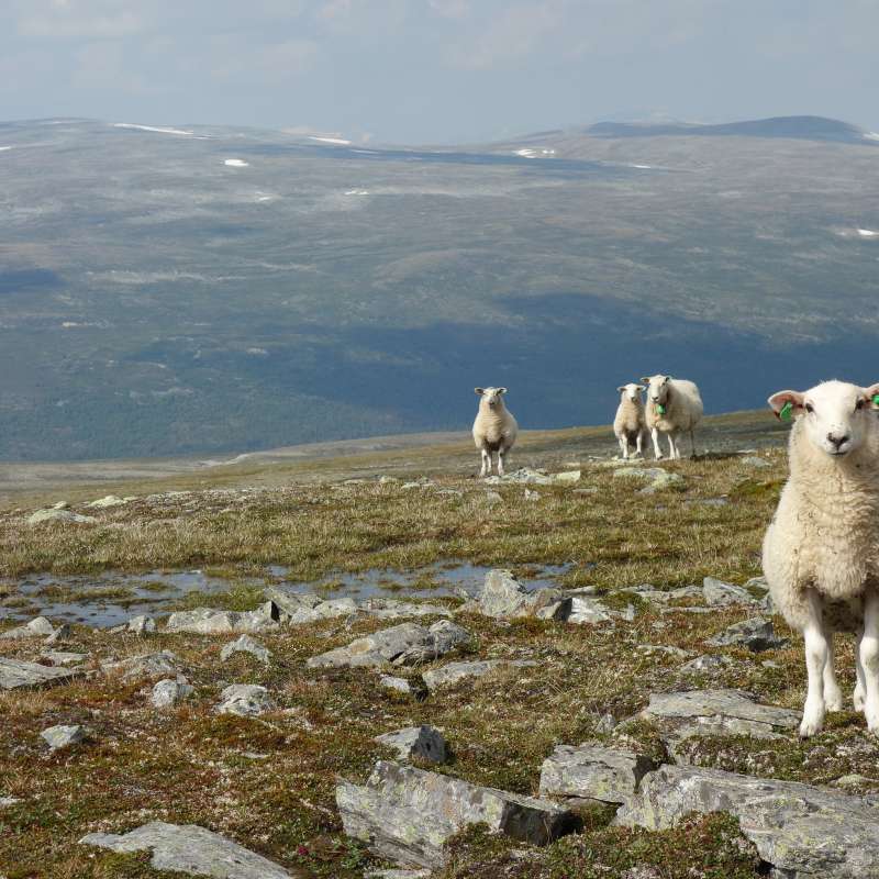
Norsk institutt for bioøkonomi har i 2023 og 2025 utført vegetasjonskartlegging i Sømna kommune, Nordland fylke. Kartlagt areal er 131 km². Kartlegginga er utført etter instruks for kartlegging i målestokk 1:20 000 - 50 000 (VK25). Det er laget vegetasjonskart og avleda temakart for sauebeite og storfebeite. Rapporten beskriver metode for kartlegging og beiteberegninger, registrerte vegetasjonstyper, beregnet beiteverdi og beite-kapasitet, samt råd omkring skjøtsel av kulturlandskap og utnyttelse av beitet. Denne rapporten bygger på NIBIO rapport 10(68) 2024, som omhandler kartleggingen som ble utført i 2023.
Forfattere
Katrine Marie Brynildsrud Peter Horvath Michael Angeloff Wenche Dramstad Adam Eindride Naas Kerstin Potthoff Anders BrynSammendrag
Expanding cities and urban densification is one of the major threats to biodiversity, ecosystem services and human welfare. Using Oslo, the capital city of Norway, as a case study this study addresses the following questions: (i) What vegetation changes have occurred between 1980s and 2021 and to what extent? (ii) What are the potential consequences of documented changes for biodiversity and other functions of green spaces? (iii) What future direction is the present development plan aiming for? To answer these questions, detailed vegetation maps (1:10 000) of Oslo from around 1980s were remapped in situ in 2021. We present results on land cover transformations, area statistics, and analyses of ecological impacts using landscape metrics. Our results document that large areas previously covered by vegetation types and cultivated land have been lost to urban densification. Housing dominated the new use. This loss of areas with vegetation types will affect ecosystem diversity negatively. On average, the total area and the mean patch area of each vegetation type decreased, whereas the mean Euclidean nearest-neighbor distance increased. These changes have lowered connectivity and increased fragmentation. Despite explicitly stated aims, previous efforts to reduce loss of areas with high biodiversity and maintain urban green spaces have not succeeded, and the planned future urban development indicates that a further decrease will follow in the next decades.
Sammendrag
Utmarksbeite er ein viktig ressurs for norsk landbruk, og 48 % av norske driftseiningar slapp dyr i utmark i 2024. Likevel er mykje av ressursen ubrukt – husdyrtalet kan tredoblast utan at beitegrunnlaget blir overskride. Ressursundersøkinga «Arealrekneskap i utmark» gjev ein samla oversikt over utmarksbeiteressursane både nasjonalt og fylkesvis.
Divisjon for skog og utmark
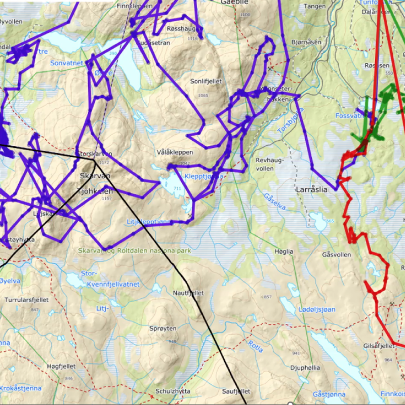
Jerv som predator på småfe i Nord-Gudbrandsdalen
I dette prosjektet skal vi dokumentere jervens rolle som skadevolder på sau, og identifisere effektive tiltak for å forebygge slike tap. Prosjektet gjennomføres i fem kommuner i Nord-Gudbrandsdalen som har hatt store tap til jerv. Funn og metoder herfra vil ha overføringsverdi til andre deler av landet.
Divisjon for skog og utmark
SPOR
Prosjektet