Remote Sensing and Forest Inventories Contribute to Saving Tropical Forests
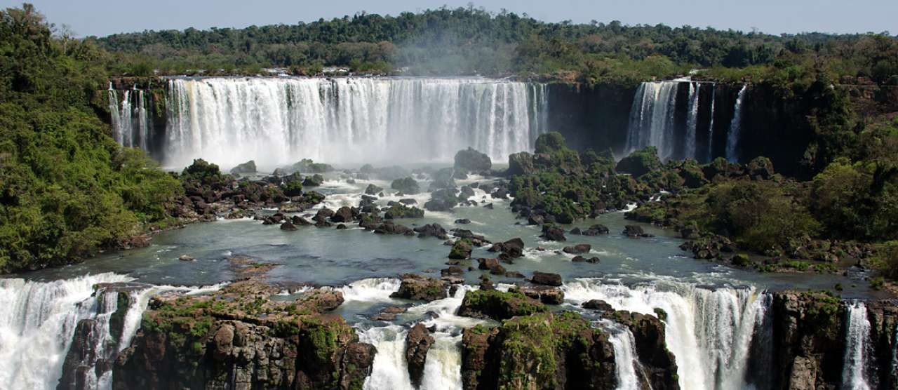
Protected subtropical forest at Iguazu Falls, Argentina/Brazil. Photo: Morten Günther.
REDD+ aims to save and protect tropical forests, thus playing a major role in combating climate change and protecting biological diversity. However, many tropical countries lack the necessary forest monitoring method required for REDD+ funding, such as remote sensing with radar satellites and nation-wide forest inventories.
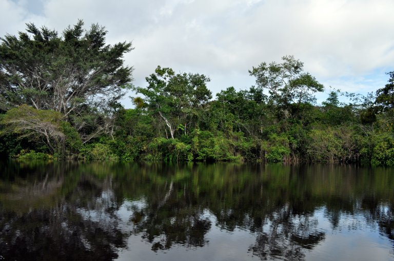
Deforestation amounts to 130.000 km2 every year. This is equal to 60.000 soccer fields each day, and takes place mainly in tropical forests in the Amazon, Central Africa, and Southeast Asia. If all the carbon in the cut forest is converted to CO2 it amounts to 10-15 per cent of the global emissions of greenhouse gases.
REDD+, an acronym for Reducing Emissions from Deforestation and land Degradation, is an initiative to use economic incentives to save tropical forests from being cut and on-the-ground activities to prevent deforestation and land degradation.
Several countries, including Norway, have pledged billions of dollars in order to support tropical countries that wish to reduce deforestation and protect their forests. In Norway it’s Norway’s International Climate and Forest Initiative (NICFI) that supports the REDD+ international agenda and administers the REDD+ funds through multilateral and bilateral initiatives.
NICFI pledges up to NOK 3 billion each year to help save the world’s tropical forests. At the same time, the forest initiative aims to improve the livelihoods of those who depend on and live in and near the forests.
REDD+ is a performance-based payment system that values carbon in standing trees. REDD+ works as follows: Tropical countries will be compensated for carbon that is stored in their forests as a result of a REDD+ project compared to a benchmark called forest reference emissions level. The more the rainforest countries reduce deforestation or forest degradation, or their forests store more carbon through various management and conservation activities, the more REDD+ funding they shall receive.
But how to verify that deforestation or forest degradation is actually reduced? How can tropical countries prove that the tropical forest is not already cut or that illegal cutting is not accounted for? REDD+ has the best of environmental intentions, but tropical countries need methods to document this.
Eyes in the air and feet on the ground
The solution is both up in space and on the ground. First the high-tech space part: Protection of tropical forests can be verified via satellite monitoring. In many countries tropical forests, such as the Amazon and the Congo basin, cover vast and inaccessible areas. Satellites make it possible to detect clear cuttings over extensive areas. Ideally we would use 3D images from radar satellites. 3D gives an estimate of tree height, and thus better estimates for carbon storage, and, because radars can see through clouds, they are useful in detecting illegal cuttings.
Moreover, radar data can also detect gradual forest changes, such as degeneration and growth. Neither of these is possible with conventional 2D data.
Secondly, precise images from remote sensing, such as 3D satellites, require knowledge of what is actually on the ground, the so called “ground truth”. And ground truth is the good old fashioned forest inventories, where skilled personnel systematically survey a nation’s forest. If done properly, and over many years and decades, a nationwide forest inventory can yield valuable information about the state of the forest, information that is of great importance for the use and preservation for forest ecosystems. And, perhaps most importantly when it comes to saving tropical forests, forest inventories give valuable input for estimating carbon storage.
Most tropical countries lack nation-wide forest inventories. Some countries, such as Tanzania, have had their forest surveyed, but perhaps only once.
Tanzania with a new system for carbon monitoring
Payments for protection of tropical forests necessitate systems for monitoring, reporting and verification of carbon emissions and carbon uptake. In January 2016, Tanzania launched a national carbon monitoring center (NCMC), though financial support from Norway’s Ministries of Foreign Affairs, and Climate and Environment. The funds are administered by the Norwegian embassy in Dar es Salaam.
The center is at Sokoine University of Agriculture in Morogoro. The main purpose of the center is “to build national capacity to measure, verify and report adequately on carbon emissions at national and international level”.
NIBIO is the major technical partner to assist Tanzania’s national carbon monitoring center, and has taken part in the development and establishment of the center. NIBIO’s Dr. Belachew Gizachew is appointed as a senior advisor to the NCMC.
- Our first goal is to report the carbon emissions from the forest sector. The carbon reporting will be done directly to UN’s Framework Convention on Climate Change. But over time there is a potential to report carbon emissions from other land based sectors such as the agriculture, says Gizachew.
The major sources of data for the NCMC will be remote sensing and ground based forest inventories.
- Norway’s national forest inventory is almost 100 years old, and it’s administered by the Norwegian Institute for Bioeconomy Research. NIBIO also has a strong research environment in remote sensing, Gizachew says.
KONTAKTPERSON
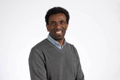
Belachew Gizachew Zeleke
Forsker
-
Divisjon for skog og utmark
(+47) 902 48 909 belachew.gizachew@nibio.no Kontorsted: Ås - Bygg H8
Facts about Norway’s National Forest Inventory (NFI)
Norway’s national forest inventory was established in 1919, and it was the first in the world to systematically measure the forest resources in the whole country.
- Read more about how Norway saved its vanishing forests
- See video about Norway’s national forest inventory
Today Norway’s nearly 100 year old forest inventory is administered by the Norwegian Institute for Bioeconomy Research. Around 12.000 forested field plots are visited and everything from tree height and trunk diameter, to old growth, rare species and moose droppings, is measured in order to provide a vital and thorough forest statistic to the Norwegian society.
KONTAKTPERSON
Belachew Gizachew Zeleke
Forsker
-
Divisjon for skog og utmark
(+47) 902 48 909 belachew.gizachew@nibio.no Kontorsted: Ås - Bygg H8
Tekst frå www.nibio.no kan brukast med tilvising til opphavskjelda. Bilete på www.nibio.no kan ikkje brukast utan samtykke frå kommunikasjonseininga. NIBIO har ikkje ansvar for innhald på eksterne nettstader som det er lenka til.