
Diress Tsegaye Alemu
Research Scientist
Attachments
CVBiography
I hold a PhD degree in Management of Natural Resource Management (2010) at the Norwegian University of Life Sciences (NMBU), Norway. I have over 20 years of international research and teaching experience in ecology and management of natural resources. previously, I worked a researcher at the University of Oslo and NMBU from July 2010- February 2023. My research focuses on patterns and processes in agricultural and natural landscapes, climate change, land use/cover analysis,, biodiversity conservation, and wildlife management. Highly skilled with long-term experiences in organizing, and analyzing ecological data and presenting results to a high standard. Published more than 50 papers and technical reports, of which 42 are peer-reviewed scientific journal articles. I have strong modelling/statistical data analysis background with very good skills in R'/Rstudio programming, ArcGIS, and QGIS softwares. I also possess project leadership with interdisciplinary multicultural teams.
Authors
Misganu Debella-Gilo Diress Tsegaye Alemu Richard Adade Deo D. Shirima Belachew Gizachew ZelekeAbstract
Remote sensing is essential for mapping mangrove forest ecosystems, yet accuracy and spatial resolution remain limited, particularly in Africa, where mangroves are fragmented, reference data and cloud-free images are scarce. The state-of-the-art of mangrove forest mapping relies on native-resolution imagery using machine learning. This study evaluates deep learning methods using aggregated multi-date satellite imagery to improve mangrove mapping and national-scale area estimation. Super-resolution and semantic segmentation techniques were applied to Sentinel-2 (S2) and Sentinel-1 (S1) images, with training data derived from field observations and high-resolution drone and satellite imagery. Coastal regions of Tanzania and Ghana were used as representative study areas for eastern and western Africa, respectively. Results show strong classification performance, with S2 imagery alone achieving an Intersection over Union (IoU) of 85.8%. Adding S1 provided modest gains (IoU 86.3%), while super-resolution significantly improved the accuracy (IoU 88.5%). The combined super-resolved S2 and S1 dataset yielded the highest performance (IoU 89.2%). Wall-to-wall mapping and statistically rigorous validation and area estimation produced accurate results with quantified uncertainty. Tanzania showed high consistency (F1 = 96%; 1207 km2, 95% CI [1151.7, 1263]), while Ghana exhibited slightly higher uncertainty (F1 = 92%; 92.6 km2, 95% CI [87.5, 97.7]). Integrating deep learning with multi-date, multi-sensor fusion and super-resolution enables accurate mangrove mapping and area estimation for improved coastal management and restoration.
Authors
Desalegn Chala Diress Tsegaye Alemu Habtamu Alem Belachew Asalf Tadesse Melesse Eshetu_Moges Nega Tassie Abate Ayalew Wondie Aklilu Tilahun Tadesse Abebayehu Aticho Alemu Gonsamo Lanhui Wang Erick Lundgren Jeffrey Kerby Jens Christian SvenningAbstract
Abstract Water hyacinth is among the world’s most damaging aquatic invasive plants, forming dense mats that disrupt ecosystem functioning, fisheries, navigation, and livelihoods across tropical and subtropical freshwater systems. Its rapid spread is driven by clonal propagation, short life cycles, and prolific seed production, particularly under nutrient-enriched conditions. Although mechanical, chemical, and biological control methods are widely applied, their long-term effectiveness remains uncertain when underlying eutrophication persists. Here, we present a large-scale, one-time water hyacinth removal campaign in Lake Tana, Ethiopia’s largest lake and a UNESCO Biosphere Reserve, as a representative nutrient-rich tropical freshwater system. Using high-resolution satellite imagery, we quantified coverage one month before removal, one month after removal, and one year later. We integrated SWOT (Strengths, Weaknesses, Opportunities, Threats) analysis with a socio-ecological system map to assess mitigation mechanisms and identify sustainable management pathways capable of providing long-term solutions to halt water hyacinth proliferation in freshwater bodies. The campaign removed over 75% (~1271 ha) of water hyacinth, yet within one year the plant resurged to levels ~18% higher than pre-removal. This rebound highlights the ecological resilience of water hyacinth and the limitations of short term, noncontinuous control strategies. Our analysis identifies unmanaged catchment nutrient inputs as the primary driver of proliferation. Lake Tana serves as a model system demonstrating that water hyacinth functions less as a traditional invader and more as a bioindicator of eutrophication. We propose a transferable conceptual and methodological framework combining continuous removal, catchment-based nutrient management, and circular bioeconomy approaches, offering globally relevant lessons for sustainable management of nutrient-enriched tropical freshwater systems.
Abstract
Fuglebestandene i det norske jordbrukslandskapet går tilbake. Nye tall fra 3Q-programmet viser en nedgang på rundt 25 prosent siden 2000. Utviklingen tyder på at endringer i arealbruk og driftsformer påvirker leveområdene til mange arter, og viser behovet for målrettede tiltak for et mer variert jordbrukslandskap.
Division of Forest and Forest Resources
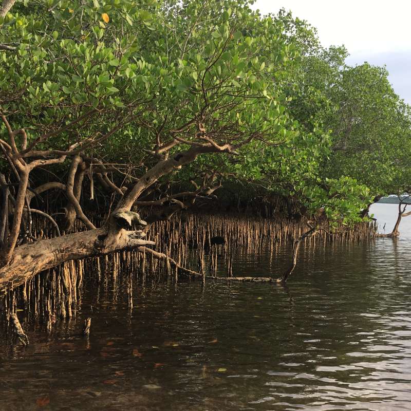
Co-developing Decision Support System for Coastal Mangrove-based Socio-ecological Systems in Eastern and Western Africa (CoastMan)
Coastal Mangroves in Eastern and Western Africa offer coastal communities much-needed ecosystem services and protection against key climate change risks, including risks to low-lying coastal-ecological systems, risks to terrestrial and ocean ecosystems, and as a result, risks to food security.
Division of Forest and Forest Resources
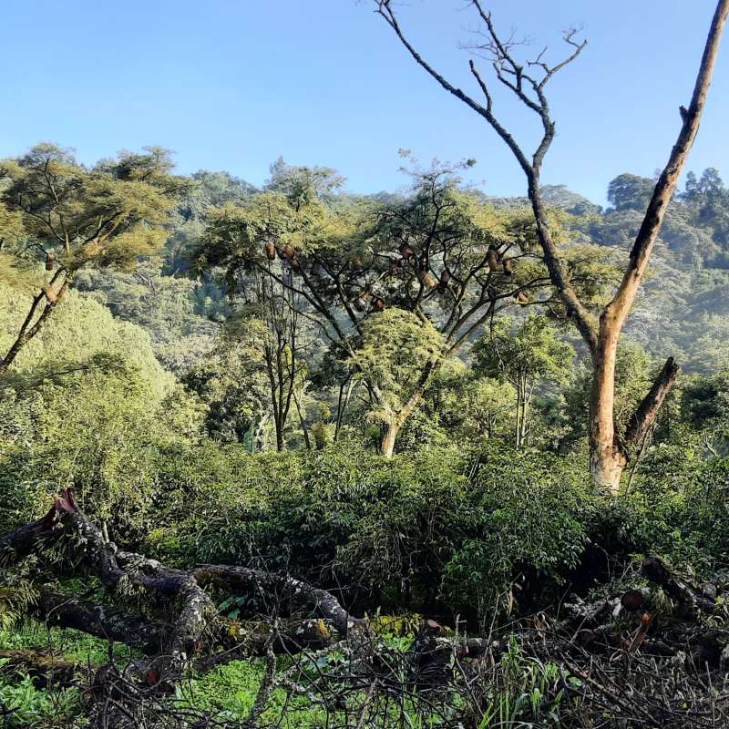
Optimizing Carbon, Soil Health and Yield in Coffee-Forest Systems as a Climate-Smart Land Management in Ethiopia (CoffeeLand)
CoffeeLand is an interdisciplinary research project aimed at advancing climate-smart land management in Ethiopia’s coffee-forest systems, which are critical for biodiversity, livelihoods, and global Arabica coffee genetic resources. These systems support millions of smallholder farmers but are increasingly threatened by climate change, land-use pressure, and declining productivity.