CO₂ emissions from cultivated peat soils may be lower than assumed

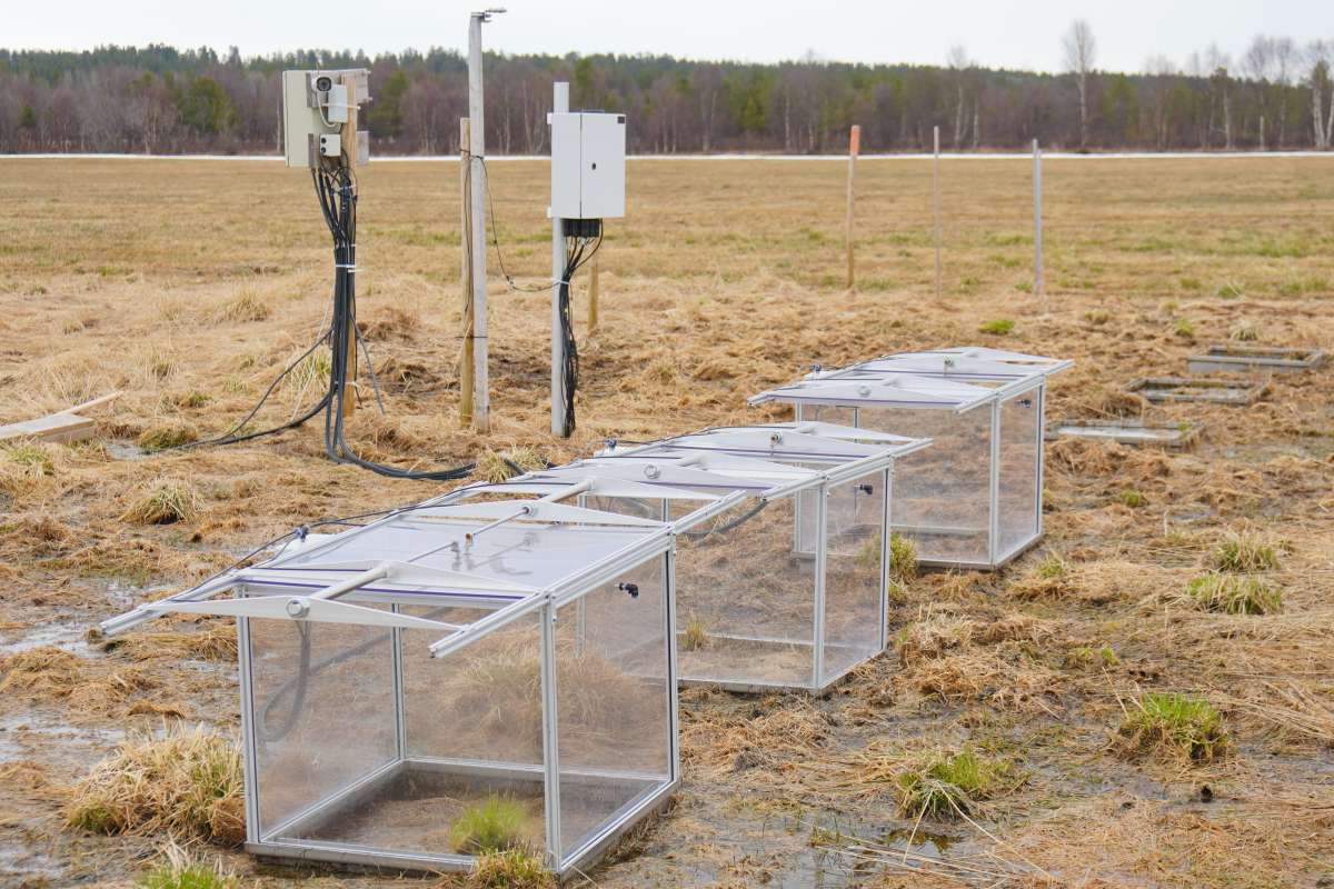
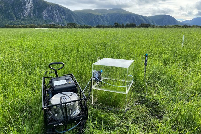
Many cultivated peatlands along the west coast of Norway have relatively high water tables due to the wet climate, where Tier 1-methodology may substantially overestimate emissions. This photo shows a cultivated peatland experiment site at NIBIO Fureneset Research station in western Norway. Photo: Junbin Zhao
Cultivated peat soils are considered a significant source of greenhouse gas emissions in Norway’s national greenhouse gas inventory reported under the UN Framework Convention on Climate Change. A new study now suggests that the current calculation method may overestimate CO₂ emissions, particularly in areas with relatively high groundwater levels.
Organic soils cover less than nine per cent of Norway’s land area, and around 65,000 hectares are currently used as agricultural land.
Emissions from these areas are presently estimated at more than two million tonnes of CO₂ equivalents per year. This is equivalent to the emissions from 400,000 fossil-fuelled cars.
New research suggests that the current method for estimating CO₂ emissions from cultivated peat soils may overestimate emissions. This suggests that national inventory figures may not fully reflect actual emission levels in different parts of the country, particularly in areas with relatively high groundwater tables.
“This does not mean that cultivated peat soils do not emit greenhouse gases, but rather that emission levels may be lower than assumed across large parts of the country,” says NIBIO researcher Dr. Junbin Zhao.
Peat soils and greenhouse gas accounting
Peat soils contain large amounts of carbon that have accumulated over long periods of time. When peatlands are drained for agricultural use, the soil is exposed to oxygen, accelerating carbon decomposition and leading to the release of CO₂.
These emissions are included in Norway’s official greenhouse gas inventory. Emissions of methane (CH₄) from drainage ditches and nitrous oxide (N₂O) from the drained area are also estimated.
Emissions from cultivated peat soils are currently estimated using so‑called Tier 1 emission factors developed by the Intergovernmental Panel on Climate Change (IPCC). These are default values applied by countries that lack detailed national measurements.
While the method is simple to use, it takes limited account of local conditions such as climate and groundwater levels.
Groundwater level is the dominant factor
In the study, the researchers applied a process‑based ecosystem model that simulates interactions between soil, vegetation, water and climate. The model was first calibrated using measurements from two cultivated peatland sites in Norway - one in western Norway and one in Finnmark County in northern Norway. It was then applied to estimate CO₂ emissions at 50 locations across the country for the period 2001–2022.
The results show that groundwater level is the dominant factor controlling CO₂ emissions from cultivated peat soils.
“When groundwater levels are very low, the IPCC default values align well with the model results. However, when groundwater levels are higher, which is common in many parts of Norway, the Tier 1 method produces much higher emission estimates than those suggested by our model,” Dr Zhao explains.
“According to our calculations, emissions from many areas may be 31 to 88 percent lower than those assumed by the current Tier 1 methodology.”
Climate and regional differences also matter
The study also shows that climate plays an important role. In warmer regions with longer growing seasons, carbon uptake by vegetation can offset a larger share of soil emissions than in colder areas.
This means that the same type of soil can result in different emission levels depending on geographic location.
“This highlights the limitations of using a single emission factor across a country with highly variable conditions,” says Dr Gunnhild Søgaard, Head of Research at NIBIO and co-author of the study.
Implications for mitigation assessments
If emissions from cultivated peat soils are overestimated, the potential for emission reductions may also be misrepresented. This can make it more challenging to assess which mitigation measures are most effective.
More detailed estimation, so‑called Tier 2 or Tier 3 methods, can provide more accurate results. These methods are based on national measurements and models that better reflect local conditions. However, they require more comprehensive data from peatland sites across Norway’s highly variable landscapes - data that are currently unavailable.
“More accurate estimates would make it possible to design more targeted climate mitigation policies,” says NIBIO researcher and co-author Christian Wilhelm Mohr.
“This would allow priority to be given to areas with high emissions, rather than applying the same measures uniformly across regions - including those with low emissions.”
Need for improved data
The researchers emphasise that their findings do not imply that the standard methodology is “wrong,” but rather that it is coarse and associated with substantial uncertainty.
“This is particularly the case in countries with highly variable climate and drainage conditions, such as Norway,” Dr Zhao notes.
“To obtain a more accurate picture of emissions from cultivated peat soils, we need more field greenhouse gas measurements and better knowledge of how groundwater levels and management practices vary locally.”
Increased efforts to collect data from peat soils would provide a more robust basis for future greenhouse gas inventories in Norway. This could contribute to more targeted and effective climate mitigation measures.
Contacts

Junbin Zhao
Research Scientist
-
Division of Environment and Natural Resources
(+47) 413 71 584 junbin.zhao@nibio.no Office Location: Ås H8
What do Tier 1, Tier 2 and Tier 3 mean in IPCC greenhouse gas inventories?
The IPCC (UN’s Intergovernmental Panel on Climate Change) classifies methods for estimating greenhouse gas emissions into three tiers, reflecting increasing levels of methodological complexity and data requirements.
Tier 1
The simplest approach. Uses global default emission factors and limited national data. Intended for countries with scarce measurement data, but often associated with high uncertainty.
Tier 2
Builds on the Tier 1 framework but applies country‑ or region‑specific emission factors. This improves accuracy but requires national measurements.
Tier 3
The most advanced approach. Uses detailed models and/or extensive measurement datasets that capture local conditions, temporal variability and management practices. Provides the most accurate estimates,but is also the most resource‑intensive.
According to the IPCC, Tier 2 and Tier 3 methods are generally considered more accurate than Tier 1, particularly for emission sources that vary strongly with climate, land use and management.
Contacts
Junbin Zhao
Research Scientist
-
Division of Environment and Natural Resources
(+47) 413 71 584 junbin.zhao@nibio.no Office Location: Ås H8