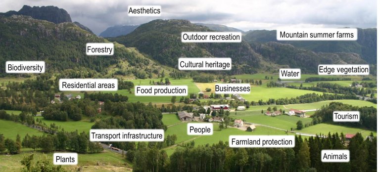
Our main topics are:
- Driving forces and consequences of landscape change.
- Indicators for landscape monitoring, nationally and regionally.
The department is responsible for two national programmes:
- Monitoring the agricultural landscape (3Q) and analysing effects of policies: Land use, biological diversity, cultural heritage and accessibility.
- Reference system for landscape character: Agricultural regions, landscape regions and sub-regions.
We provide administrative support based on research, partly long-term financed and partly project-based. The department develops and tests new indicators by conducting research on our own data, on data from other departments in the Division of Geography and Statistics, and through extensive national and international research collaboration.
The department’s staff is multidisciplinary including the following fields:
- Physical and human geography
- Biology and nature management
- Landscape and vegetation ecology
- Agricultural economics
Our key methods include:
- GIS-analysis of aerial photographs and other data.
- Landscape photography.
- Field registration of biological diversity, especially vascular plants and birds.
- Field registration of cultural heritage sites and environments.
- Questionnaire and interview surveys.
- Analysis of documents and of statistical data.
The European Landscape Convention encourages Contracting Parties to identify their landscapes, raise awareness of landscapes as a national resource and to monitor landscape change. Our Department contributes to Norway fulfilling these aims.