New technology provides higher geographical accuracy in risk maps
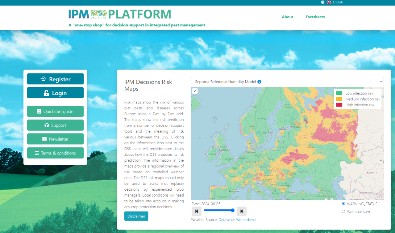
Example of a risk map displaying the whole of Europe in the IPM Decisions platform. The image shows a test version, but it will soon be available to everyone at https://www.platform.ipmdecisions.net/
An innovative new tool developed by NIBIO through international projects aims to provide better risk maps for diseases and pests.
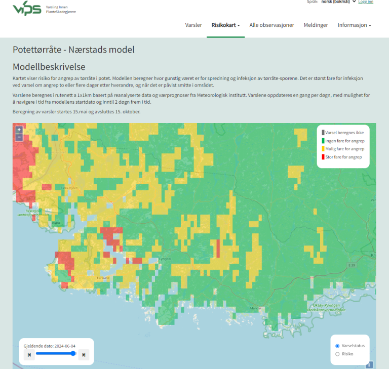
This year, Norwegian farmers will receive a new tool in the online warning service VIPS (Warning System for Plant Pests).
This involves new risk maps that display alerts for various plant pests based on weather data in a 1x1 km grid.
Synergies
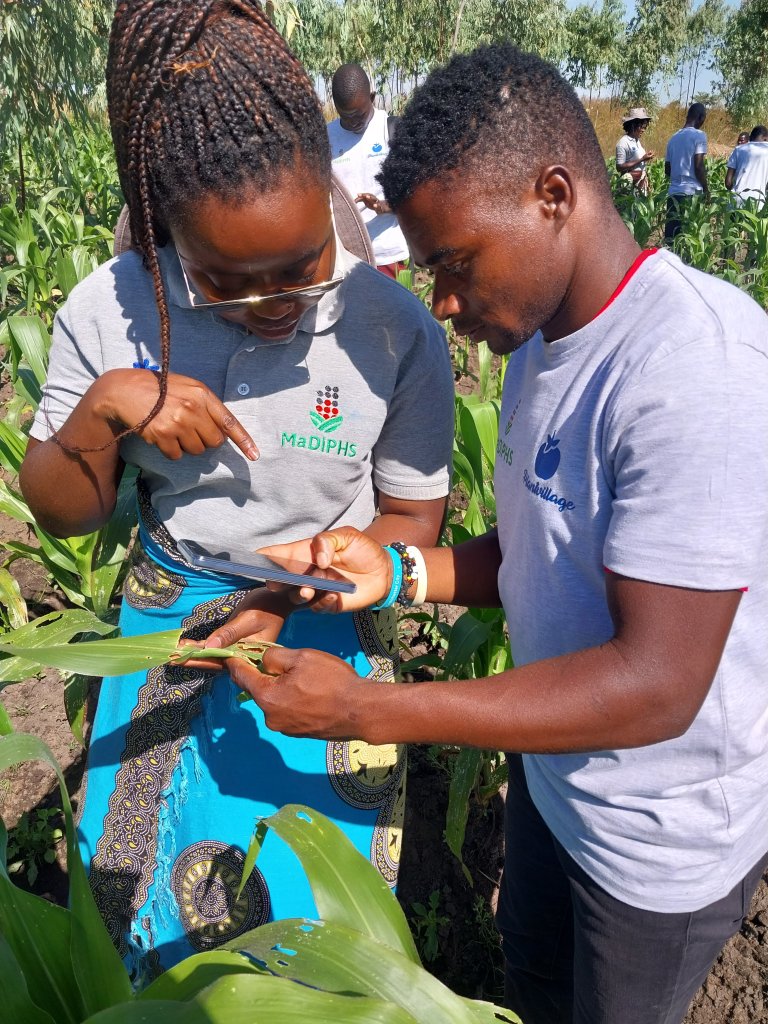
The general data foundation of the risk maps and their potential for integrating various models result from synergies between several projects NIBIO has been involved in. This includes collaborative projects like IPM Decisions and MaDiPHS (Malawi Digital Plant Health Service), where risk maps for pests will be integrated into services relevant to users in Europe and Malawi.
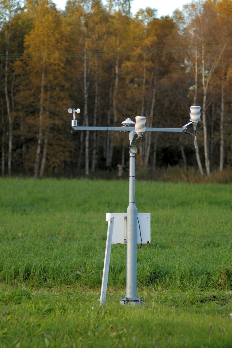
The alerts show whether weather conditions are favourable for pests to develop or spread, provided other biological conditions are met. The information in the map provides a regional overview without relying on fixed measurement stations. Similar alerts for various pests are also calculated with data from weather stations at fixed locations where more detailed calculations can be accessed through the map display on the VIPS homepage.
Generating thousands of geographical points
The carrot fly swarming period was the first model set up for display in risk maps. Risk maps show alerts in a 1x1 km grid. The alert indicates when one can expect the swarming of the first generation of carrot flies.
"The information in the map also provides a regional overview outside the fixed measurement stations. Risk maps for potato late blight were initiated in mid-May. The alert shows if the weather is favourable for spreading," says Berit Nordskog, a researcher at NIBIO.
"Users of VIPS must themselves assess whether the pest is present in the area, whether host plants are susceptible, and whether there is a need for measures. It is recommended to contact their local advisor for an assessment of necessary measures," she adds.
More accesible
Tor Einar Skog, a senior advisor at NIBIO, has been responsible for developing the new tool.
"In short, we have utilised improved and more accessible weather data sources that cover a comprehensive grid of weather forecasts with varying degrees of resolution. These data are used to calculate risk using the models we have available, which calculate risk for each individual point. We can generate thousands of points. This way, we cover larger areas and detect trends in the surrounding areas," explains Skog.
“The Norwegian Meteorological Institute has shared data with us. And we use German weather data from the European IPM Decisions project to run models for all of Europe. The European data are coarser than the Norwegian ones, but they have been useful for our purposes," says the senior advisor.”
He says the focus is on implementing models to predict the risk of various pests and plant diseases. For example, pollen beetles, codling moths, and septoria leaf blotch will be used in the IPM Decisions platform in Europe.
"In some cases, we haven't created the map ourselves but use our models to understand the risk."
Good support
"We have worked closely with the Meteorological Institute and developed standards for displaying such models geographically and over time. This has led to us improving our services and making them more accessible to users. Everything we do is still open and available to everyone," emphasises Skog.
He mentions that they have also received help from Johnathan Rizzi at NIBIO, an expert in big data, to develop the existing grid network.
"Weather data are becoming increasingly available, and we believe that our approach to using these data will be innovative and useful, especially in IPM Decisions and in countries like Malawi. None of this would have been possible without the support and help from the Meteorological Institute," he concludes.
Contacts

Tor-Einar Skog
Senior Adviser
-
Division of Biotechnology and Plant Health
(+47) 913 03 819 tor-einar.skog@nibio.no Office Location: Ås H7
VIPS
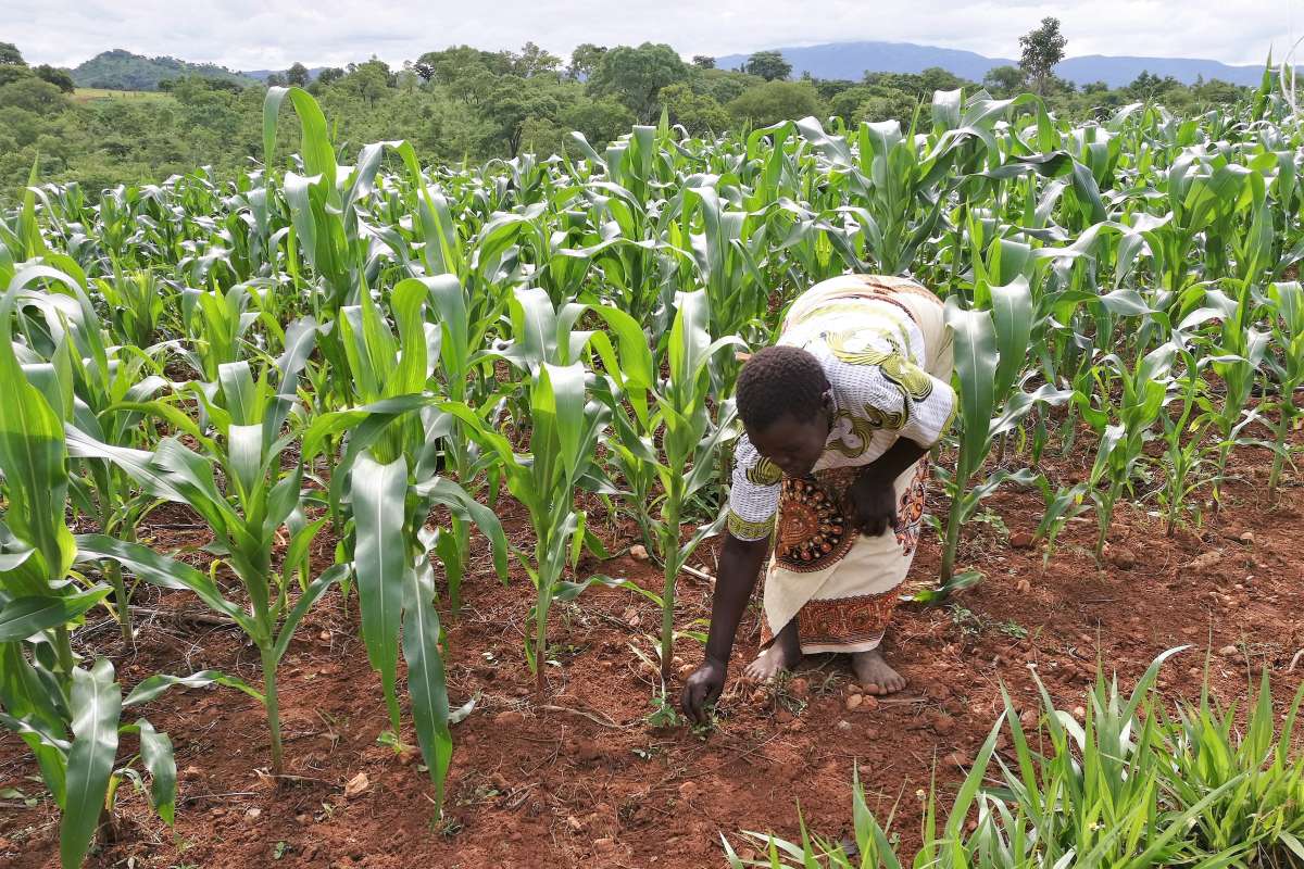
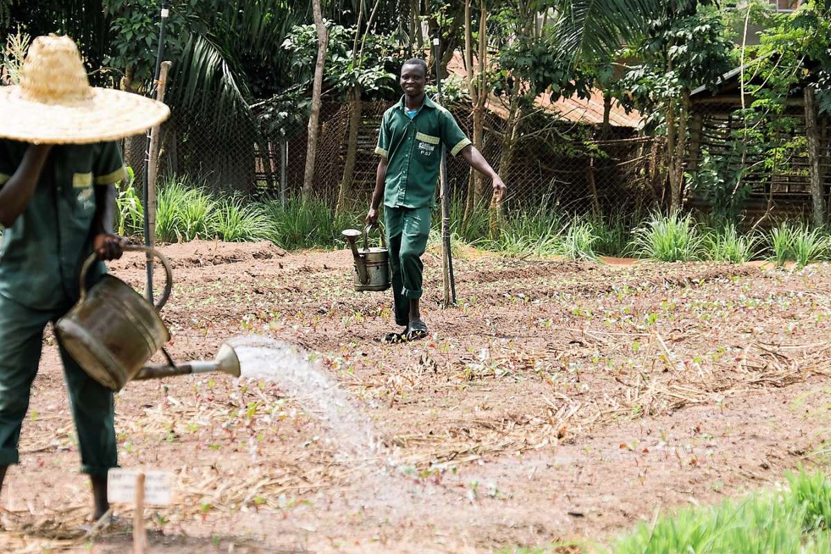
VIPS is an online forecast and information service for decision support in integrated management of pests, diseases and weeds in agricultural and horticultural crops. The service is open source and accessible to everyone but is particularly aimed at farmers and advisers in Norwegian agriculture. The VIPS technology platform is based on open-source code and is also part of several international projects.
Since 2014, VIPS has been an element of several international projects related to development of integrated pest management tools in Europe, Asia and Africa, including collaboration with organisations such as FAO and IITA. VIPS has been authorised by the UN as a global digital public goods.
VIPS Risk Maps Risk maps show forecasts for various plant pests based on weather data in a 1x1 km grid. The forecasts indicate whether weather conditions are favourable for the development or spread of a pest, provided that other biological conditions are met.
IPM DECISIONS
IPM Decisions aims to increase the usefulness of digital Decision Support Systems (DSS) for Integrated Pest Management (IPM). The project will deliver DSS, data, tools, and resources through a pan-European online platform and an IPM decision network.
Contacts
Tor-Einar Skog
Senior Adviser
-
Division of Biotechnology and Plant Health
(+47) 913 03 819 tor-einar.skog@nibio.no Office Location: Ås H7