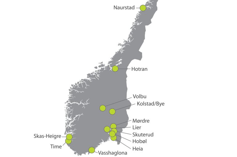
JOVA has established a nationwide network of monitoring stations in small catchments dominated by agriculture (figure 1). Data from monitoring of runoff and water quality are supplemented by registrations of the farmers’ agricultural activities in the catchment area. The data collection on management practices is done in close co-operation with the farmers, and provides a basis for correlating soil and crop management in the catchments with the observed water quality in the streams. In many of the catchments the monitoring includes nutrients / soil erosion as well as pesticides, while in some localities only nutrients / soil erosion or pesticides is monitored.
Characteristics of the JOVA catchments
The JOVA catchments represent the most important agricultural areas in the country with regard to climate, soil and management practices. The monitoring includes a total of 13 catchments located in different parts of the country.
The Skuterud, Mørdre and Kolstad catchments are dominated by grain production, while Volbu, Naurstad, Time and Skas-Heigre are dominated by grass and livestock production. Hotran is characterized by a combination of grain / grass cultivation, with grain as the dominant crop. Vasshaglona is characterized by a combination of potato, vegetables and grain crops.
There have been some minor changes in the crop distribution in some of the fields through the monitoring period. In Mørdre the area of potatoes has increased in recent years, while the area of meadow grass has increased somewhat in Hotran. The area of pasture has increased in Naurstad at the expense of the meadow. Also in Volbu there has been a small increase in grazing areas. In Time and Skas-Heigre, there has been little change in farming. In Vasshaglona there has been an increase in the acreage of vegetables at the expense of potato areas.