Division of Environment and Natural Resources
SOILSPACE
End: feb 2019
Start: mar 2015
SOILSPACE: Quantifying Soil Structure to Augment the Relevance of Laboratory-Based Soil Hydraulic Properties for Environmental ModellinG
Partner institutions
Rutgers University, The State University of New Jersey, New Brunswick, NJ, USA
Swedish University of Agricultural Sciences, Uppsala, Sweden
Norwegian University of Life Sciences, Ås, ,Norway
| Start - end date | 01.03.2015 - 28.02.2019 |
| Project manager | Attila Nemes |
| Division | Division of Environment and Natural Resources |
| Department | Hydrology and Water Environment |
| Funding source | The Research Council of Norway - FRINATEK |
Retention and flow of water in soils affect the quality of life of a society by influencing:
- food and fiber production (via supporting plant growth)
- water quality (via e.g. soil erosion), and
- the safety of humans and their possessions (via flooding and land-slides).
Mathematical modelling is perhaps the most effective tool for hypothesis testing and event-forecasting of these phenomena. Since modeling of water flow in soils is an essential component in these models, accurate values of the soil properties defining the retention and flow of water (hydraulic properties) are required.
Measurement of these properties in the laboratory is time consuming and expensive; therefore, they are often estimated from basic soil properties. Current estimations of soil hydraulic properties are uncertain because:
- measurements in the laboratory poorly represent hydraulic properties in the field
- estimation approaches are often based on measurements on disturbed soil samples, while a correct representation of the hydrological processes in the field requires quantifying the undisturbed 3D pore space of the soil.
Aims of the project
The aims of this project are to:
- Quantify the complex 3D soil pore system
- Translate improved laboratory soil data into new methods for estimating soil hydraulic properties relevant at the field scale.
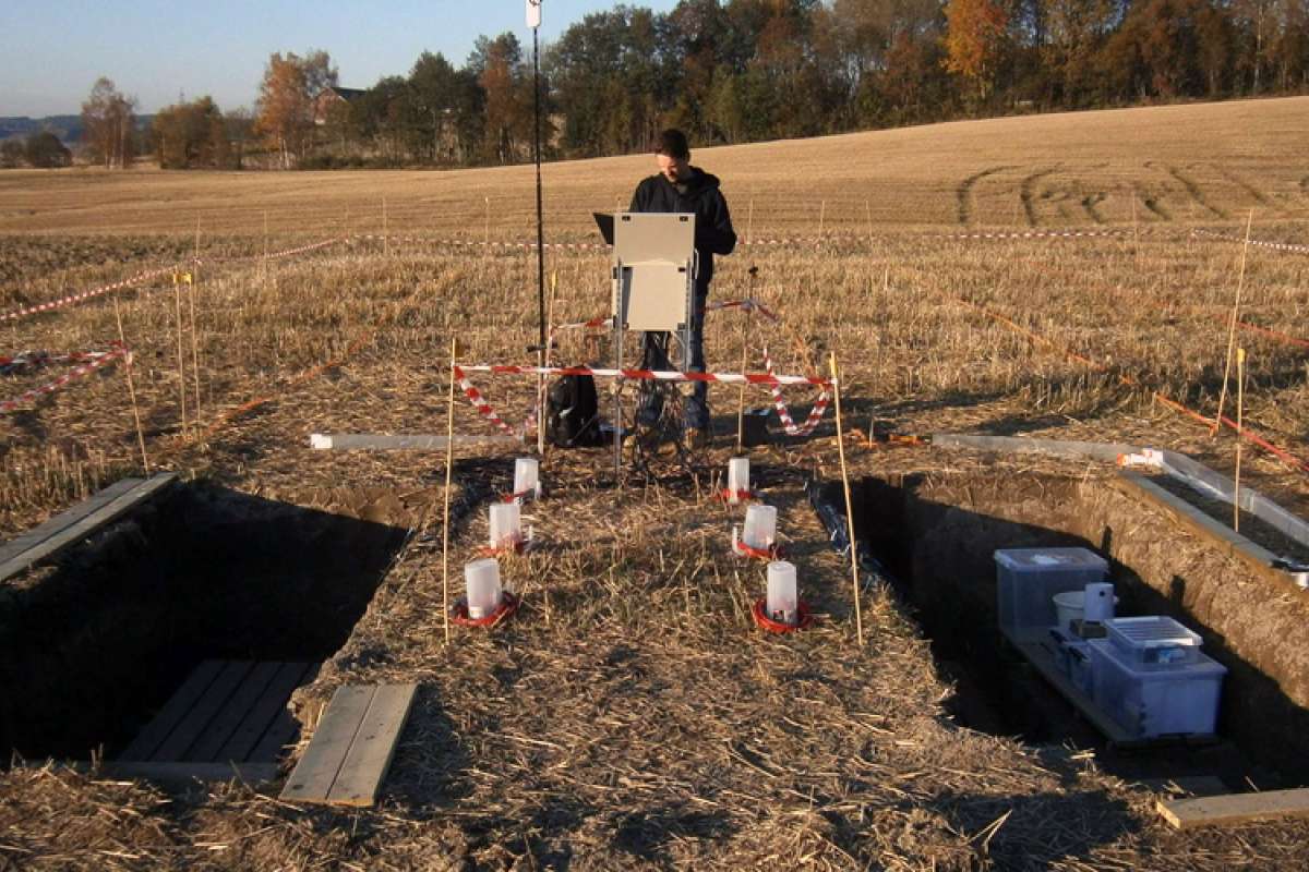
Soil core data from agricultural areas of Norway, representing a wide range of soil types, is being collected for this project. In addition, two intensively investigated field-sites are used as pilot areas to test the proposed methods. Data mining tools will be used on data from ongoing laboratory measurements and 3D imaging of the soil pore structure to help parameterize our simulation model; and field installations of geophysical and soil moisture sensors at the two pilot sites collect data to field validate our new approaches.
The study promises to provide new and improved foundations for modelling environmental processes.